Believe it or not, knowing if the ground is wet or dry is an essential metric for science. Soil moisture influences local weather patterns, the likelihood of flooding, and whether or not crop and plants are healthy.
But it’s tedious to measure soil moisture on the ground. For decades scientists wanting to understand this needed to either take physical samples of the soil or rely on data from low fidelity satellites.
Neither option was great. So in 2015 NASA launched its Soil Moisture Active Passive (SMAP) satellite, the first dedicated satellite to give researchers a daily measurement of how wet the ground is nearly everywhere on Earth. This past April all that data was integrated in the United States Department of Agriculture Foreign Agricultural Service’s (USDA FAS) Crop Explorer tool, which provides farmers and stock traders real-time global information about crop health, a near-real time picture of how wet the ground is around the world.
“If you think about when your body sweats and cools through evaporative cooling, the same thing happens on the Earth’s surface,” says John Bolten, a physical scientist at NASA’s Goddard Space Flight Center. “The amount of moisture in the soil impacts local weather and drives land-atmosphere interaction. If you’re interested in flooding or drought you can assess and predict future conditions by looking at the soil moisture.”
And for agriculture, Bolten says, soil moisture measurements are especially important because an agricultural drought is different from other types of drought. Meteorological drought, which is what is happening in California, is a lack of precipitation. Hydrological drought is when the flow of water downstream decreases. In an agricultural drought, however, there is actually a deficit of moisture in the soil and it directly impacts the amount of water available to plant roots.
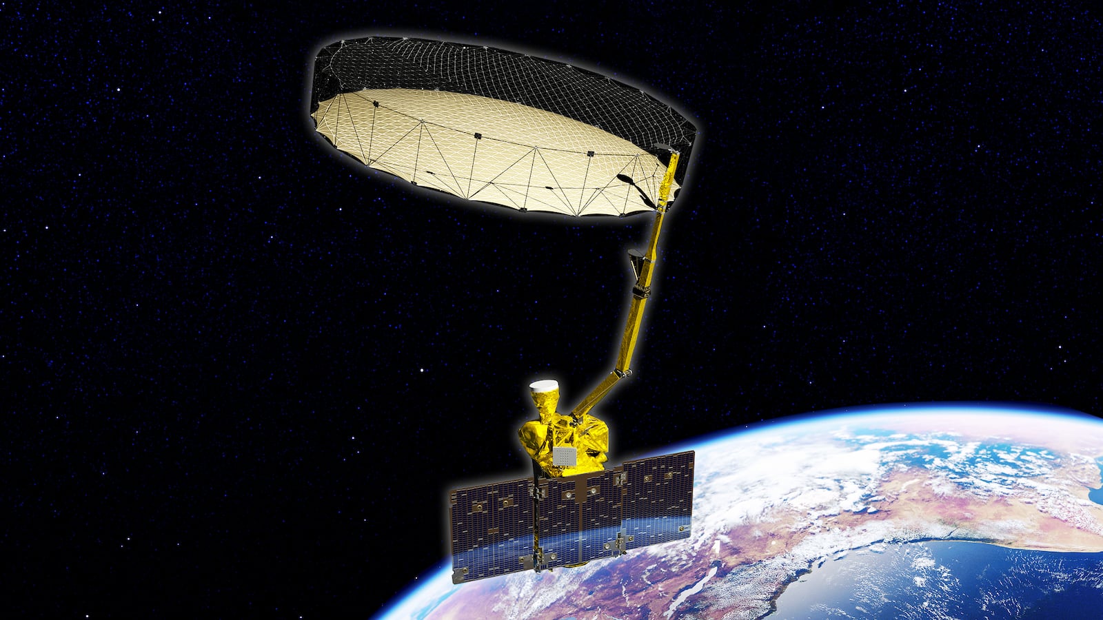
With SMAP, scientists (and anyone who wants to access the data, which is open source) finally have the ability to observe the top two inches of soil surface around the world. And, while other missions previously have measured soil moisture, they haven’t done it at such a high fidelity or resolution. Part of the reason why those interested in soil moisture had to wait so long to have a technology that provided them this level of data was because the sheer size of the technology necessary to capture it.
“The way that the SMAP mission is novel and innovative is that it combines active and passive sensing. Passive sensing is a camera like your eyeball collecting microwaves. Active is sending out energy and recording the backscatter,” Bolten explains.
Measuring passive microwaves, he says, is very difficult because microwaves are very long. So the antenna that captures them needs to be very large. “They had to throw a six-meter diameter dish in space, which had never been done before,” Bolten says. “So they came up with this cool mesh system that folds up into a rocket. Then after it launched, it opened up like a flower.”
Recently all that data has been integrated in the United States Department of Agriculture’s Crop Explorer tool, which makes global estimates of crop availability. “They [the USDA and their Crop Explorer tool] do this because agriculture is a global enterprise now,” Bolten says. “The cost of wheat in the U.S. depends on the productivity of wheat in Asia and South America. It’s all connected.
“This provides USDA FAS with prompt information on the current state of agriculture commodities,” he continued. “It allows them to predict changes in international market conditions. This is very, very serious business. We’re providing this to FAS and it’s driving their crop models and crop stress alarms and helping analysts.”
But it’s not just farmers and serious businessman that can make use of the data from SMAP. Because it’s part of NASA’s Applied Science Program, which mandates that all the data it collects is open source, there are a whole slew of communities that could potentially benefit. The Applied Science Program has partnered with Google Earth to provide the first satellite soil moisture data to the app.
What’s noteworthy is that people living in less technologically advanced countries are already seeing improvements, especially in Africa, according to Bolten. “Areas that tend to be food insecure desperately need this information,” he said. “They don’t have prescription gauges and soil gauges—they don’t have meteorological stations.”
“There are just a handful of meteorological stations in entire countries and now we have reliable soil moisture estimates within four percent accuracy every two to three days,” Bolten added.