Track Irene’s path, check storm threat levels, forecast wave heights, and more with the top storm-related apps downloadable for iPhone, iPad, and Android devices.
Currently being offered at a 50 percent discount, Hurricane provides high-quality hurricane tracking maps for the iPhone and iPod, complete with a forecast cone—allowing the user to map out the path of the storm. With push notifications, a Twitter feed, and real-time news updates, Hurricane will keep both weather geeks and travelers dry and plugged in.
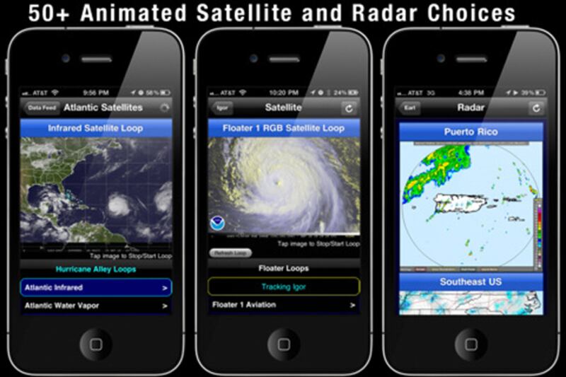
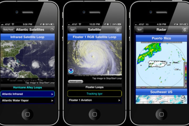
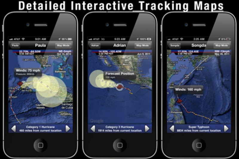
This award-winning iPad app bills itself as “The Ultimate Hurricane Tracking Experience,” and from all indications, that self-assessment rings true with users. With a 4+ rating from more than 200 users, Hurricane HD provides an extensive forecast cone, which includes both location information and corresponding wind speed. Also in the app: animated satellite images and U.S. local and regional radar.
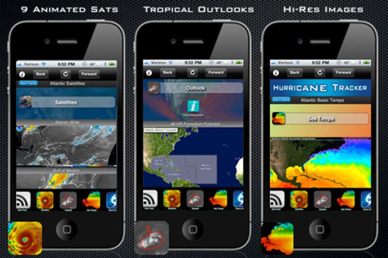
The creators of Hurricane Tracker say their iOS app surpasses the others in terms of the breadth of data provided. With tracking maps, detailed threat levels, updates from the forecaster, and alerts for changes in the storm’s intensity, HT bills itself as a comprehensive tracking application for iOS devices. Bonus: it includes checklists and storm history too.

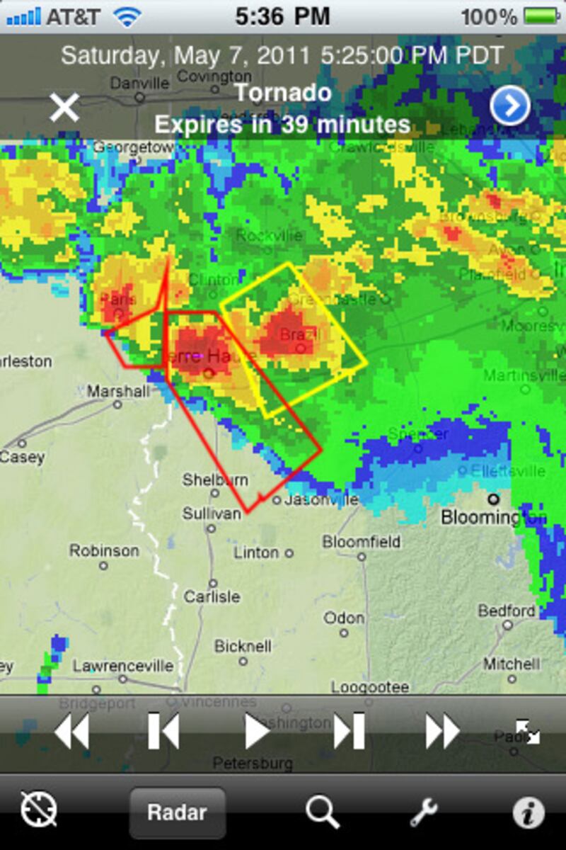
Not for weather novices, Radarscope for iOS offers an expert's view into NEXRAD Level 3 radar data combined with weather alerts issued by the National Weather Service. Built for the native iOS environment, the app allows users to pinch and zoom their way along the coast—to get the most detailed satellite view available.
For a cheaper option that still packs reliable data, try this iPhone app for animated radar to visualize incoming storms. Users can move forward or backward in time to see where the hurricane has been—and where it’s headed. Bonus: the app remembers the user, so next time you load it, NOAA Radar will be ready to display radar for your location.
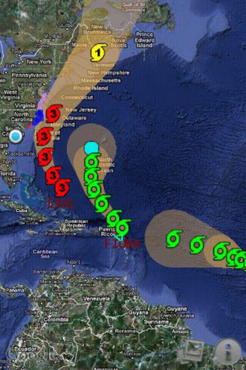
A free app for Android users, Hurricane Hound has surged in popularity over the past few days as Americans brace for Irene. With simple hurricane tracking overlaid on Google Maps, this basic app gives you the basics—where the hurricane is headed next.
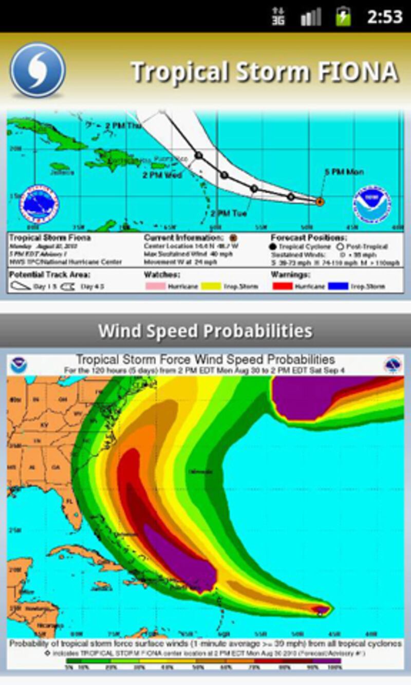
Specializing in storm activity in the Atlantic and Pacific oceans, SeaStorm provides advisories from the National Hurricane Center, forecast cones, and the ability to export screenshots of the radar to your social network du jour. For those with sea legs, SeaStorm also includes a deeper analysis of wave heights, high wind, wind/wave forecasts, and swell direction (good for low-lying areas). Bonus: as an add-on for this Android app, you get the ability to view the National Hurricane Center's interactive forecast models.