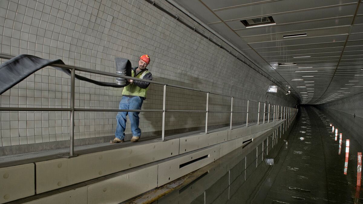
The floodwaters of Sandy highlighted the vulnerability of the Metropolitan Transit Authority, which oversees New York's subway, the Long Island Railroad, and Metro North, to a sizable storm surge and rising ocean levels. But the potential impact of such storms have been discussed for nearly a decade, and came into sharper focus in 2011 following Hurricane Irene. And New York isn't the only region whose public transit infrastructure is vulnerable to climate change and extreme weather. In 2011, the Federal Transit Administration released a report, Flooded Bus Barns and Buckled Rails: Public Transportation and Climate-Change Adaptation, which detailed the risk climate change posed to public-transit systems all over the country, and especially in New York City.

The report says that, given unavoidable warming due to greenhouse gases already emitted into the atmosphere, transit infrastructure will have to adapt to changed weather, no matter what actions are taken to reduce emissions. And it has turned out to be remarkably prescient.
Given the reality of global warming, the report says, The most disruptive near-term impact is likely to be intense rainfall that floods subway tunnels and low-lying facilities, bus lots, and rights of way. That accurately describes the state of New York's crippled public-transit system, with reduced subway and train service leading to massive traffic jams and gas shortages.
New York City's MTA is used as one of the case studies in the report. And in fact, the MTA has been thinking seriously about how to adapt to climate change to make the system more resilient at least since 2008. That year it published a report, the first of its kind, titled MTA Adaptations to Climate Change: A Categorical Imperative. This was prompted both by the overwhelming evidence linking climate change to rising sea levels as well as recent experience. In August 2007, New York City was hit with three-and-a-half inches of rain in two hours. When the MTA's pumps couldn't prevent water from reaching the electrified third rail, the disruption affected over 2 million subway riders and shut down a substantial portion of the subway system.
The MTA and FTA's findings are a sobering reminder that the transit disruption caused by Sandy could well become a regular occurrence. The MTA, in association with Columbia University researchers, found that a 100-year storm meaning a category 1 to 3 hurricane hitting near or around New York City with a two-to-four-foot rise in the sea level would mean devastation for the subways. The MTA also looked at just the 100-year storm and a 10-year storm combined with the sea-level rise and found the results about equivalent.
Without sea-level rise, a 100-year flood would inundate portions of the subway system, the report found. But with the sea-level rise, a 10-year storm could have the same effect. This means that, if sea levels continue to rise, New York City could see Sandy-like effects on its public-transit system every 10 years. And if a Sandyesque storm hits with higher seas, the tunnels under the East River and the Harlem River could be totally inundated in just 40 minutes.
When the FTA report was released in 2011, Therese McMillan, the deputy administrator of the agency, told a reporter: "The patterns are pretty indisputable. The 100-year floods are occurring every 10 to 20 years. The hurricane intensities are repeating themselves and being very common. The extreme winter effects that we're seeing in the Northeast are clearly in evidence."
New York City isn't the only metropolis that sits on an easily flooded port. But compared to its peers, like Rotterdam or Amsterdam, New York City is not as well prepared. According to a study (PDF) done in 2007 by the University of Southampton in collaboration with the risk-modeling company RMS, the New York City area has $320 billion in assets exposed to potential flooding. That's second only to Miami, at $416 billion. New Orleans, with $234 billion in assets exposed, is third.
The study looked only at the exposure of assets in a 100-year storm, which New York just experienced. That means that previous models of damage from the resulting storm surge could have undershot the real damage experienced, which is still unknown. The Southampton/RMS study also includes the sobering reminder that among wealthy, exposed port cities, New York City's flood defenses only purportedly work to protect from a 100-year storm. By contrast, the flood defenses in Shanghai, London, and Tokyo are designed for 1.000-year storms. The infrastructure protecting low-lying Amsterdam and Rotterdam are built to withstand 10,000-year storms.
Researchers have put the estimated price tag on a system to protect New York City from a Sandy-sized storm surge at somewhere between $6 and $15 billion.
That's expensive. But the cost of this insurance pales in comparison to the costs of the storm damage. While the costs of Sandy are not yet known, they could end up at some $50 billion and Moody's has put the lost economic output in just the New York City metro area at just above $11 billion. Much of this lost output can be directly attributed to the devastating hit suffered by the subway, along with regional transit lines. When people and goods can't move because of a degraded transportation infrastructure, business comes to a screeching halt.
As another report (PDF) done by Columbia researchers on New York City's vulnerability to climate change put it: "Without effective infrastructure a metropolitan region cannot exist."


