
“Cuba is a country of extraordinary beauty and breathtaking landscapes; however, due to its unique history and exceptionally restricted airspace, no photographer had ever been granted access to photograph the island from the air… until now,” writes Marius Jovaisa in his new book, Unseen Cuba. The book is a collection of magnificent photos depicting the once-estranged country very much on the minds of many an American struck by wanderlust.
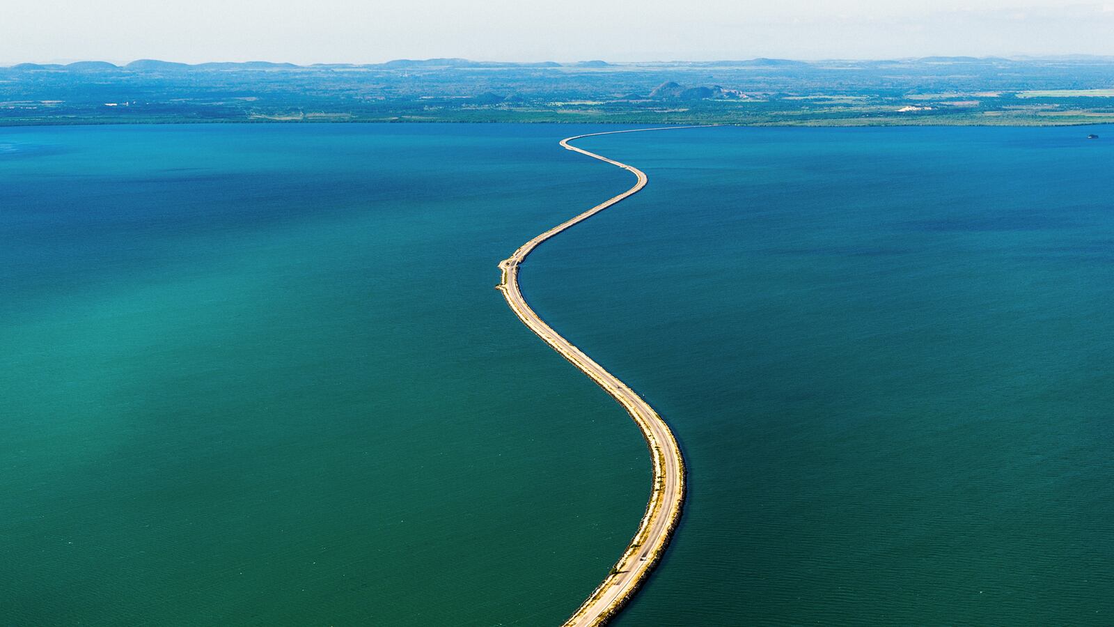
This is a photo of the El Predraplén Causeway, which was finished in 1999. As Jovaisa notes, at 30 miles long, it is held up as a major achievement of Cuban engineering.

Jovaisa's images from above capture cities, mountains, farms, and factories, but his photographs of beaches are an envy-inducing reminder of how much Americans have been missing out on for the past several decades. This photograph is of Playa Perla Blanca in Cayo Santa María.
Marius JovaisÃÂÃÂa
“The unspoiled and virtually inaccessible cays that lie off the northeastern shores of Cayo Santa María add to the stunning beauty of this area,” he writes.

Jovaisa began shooting in March 2010 and completed in June 2014, “an ultramarathon with almost countless hurdles and obstacles.” This image is of the De Sabana-Camagüey Archipelago, also known as Jardines del Rey (King’s Gardens). It is found on the north coast of Ciego de Ávila province. The archipelago is made up of around 400 coral cays and islands that remain uninhabited for the most part.

Like brushstrokes on a sandy canvas, clusters of mangroves and thin streams of water add a splash of color to the coastline of northern Ciego de Ávila province.
Marius JovaisÃÂa
Some of the more surprising photographs are of the misty mountain ranges rippling throughout the Cuban countryside. This image is of the Sierra Cristal range. According to Jovaisa, it is home to “pine forests, nickel mines, and more than 100 species of endemic flora.”
Marius JovaisÃÂÃÂa
The highest mountain in Cuba is Pico Turquino on the western part of the Santiago de Cuba province. The mountain rises nearly 6,500 feet above sea level.
Marius JovaisÃÂa
This is a photograph of agricultural fields in Granma province, which are mostly used for coffee. “These peaceful, pastoral landscapes belie the region’s connection to the revolutionary history of the country,” writes Jovaisa.

The Torreón de la Chorrera, pictured here, was built in 1646. Found at the mouth of the Almendares River, today it is a restaurant.
Marius JovaisÃÂa
A UNESCO World Heritage site, the Valle de los Ingenios was one of Cuba’s most famous centers of sugar production during the 18th and 19th centuries. This is a photograph of the tower at Manaca Isnaga Estate, which, at 147 feet, was once the tallest building in Cuba. It was used for sounding the beginning and end of working hours on the plantations.

Unseen Cuba by Marius Jovaisa. Published by Unseen Pictures Ltd.